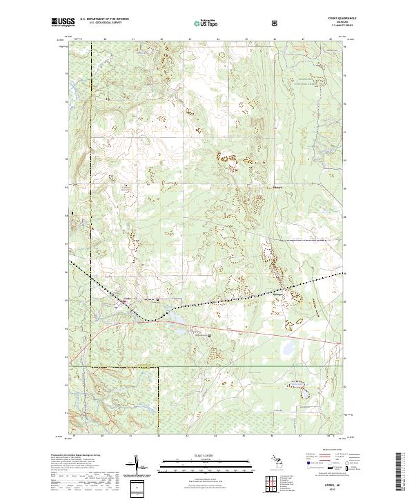
2023 Map of Cooks
USGS Topo · Published 2023About this map
The Hiawatha National Forest blankets much of this Upper Peninsula landscape, where the settlements of Cooks, Elkhorn, and Springer mark the transition from timberland to small-scale agriculture and wetland. Family history and local burial sites are prominently noted, including the Cooks Cem, the Old Cooks Cem, and the Seventh Day Adventist Cem. The terrain is defined by a complex network of water, with Cornell Lake and Michaud Lake situated among the headwaters of the Little Fishdam River and Archambeau Creek. This survey reflects the modern intersection of industry and recreation, showing a grid of forestry roads like Garden Grade Rd alongside designated trails such as the Indian-Lake-Ski-Trl. The boundary between Schoolcraft and Delta counties crosses the southwestern quadrant, illustrating how political lines bisect the drainage of Hartman Creek and Spring Creek.
Find a feature on this map
35 named features on this map. Tap any name to fly to it.
Don’t see what you’re looking for? This feature index may not catch every label — zoom into the map to look around manually.
Map Details
Editions of this 2023 Cooks Map
This is the sole edition of this map. No revisions or reprints were ever made.
Other maps of this area

1931 · Cooks NE
USGS Topo · 1:31,680

1931 · Steuben SE
USGS Topo · 1:31,680

1931 · Steuben SW
USGS Topo · 1:31,680

1931 · Cooks NW
USGS Topo · 1:31,680

1932 · Skeels Lake SE
USGS Topo · 1:31,680

1932 · Garden SE
USGS Topo · 1:31,680

1932 · Garden NE
USGS Topo · 1:31,680

1954 · Escanaba
USGS Topo · 1:250,000

1957 · Escanaba
USGS Topo · 1:250,000

1958 · Escanaba
USGS Topo · 1:250,000