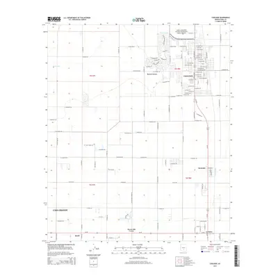
2014 Map of Coolidge
USGS Topo · Published 2014About this map
Casa Grande Ruins National Monument anchors the northern landscape of this Pinal County region, where the Gila River Valley's agricultural heritage is etched into the desert floor. The city of Coolidge serves as the primary hub, its residential grid defined by N Arizona Blvd and the industrial activity near W Industrial Dr. This 2014 survey documents a complex network of irrigation and water management, including the Pima Lateral and the S Side Canal, which sustain the surrounding fields. Smaller communities like Randolph, Eleven Mile Corner, and La Palma line the southern transit corridors, while the edges of Casa Grande and Eloy begin to emerge in the southwest. The terrain is crisscrossed by seasonal drainages such as McClellan Wash, illustrating the intersection of historic settlement patterns with modern desert water infrastructure.
Find a feature on this map
92 named features on this map. Tap any name to fly to it.
Don’t see what you’re looking for? This feature index may not catch every label — zoom into the map to look around manually.
Map Details
Editions of this 2014 Coolidge Map
This is the sole edition of this map. No revisions or reprints were ever made.
Other maps of this area

1900 · Florence
USGS Topo · 1:125,000

1902 · Florence
USGS Topo · 1:125,000

1907 · Sacaton
USGS Topo · 1:62,500

1922 · Red Rock No 2
USGS Topo · 1:48,000

1922 · Signal Peak
USGS Topo · 1:62,500

1924 · Signal Peak
USGS Topo · 1:62,500

1934 · Newman Peak
USGS Topo · 1:125,000

1954 · Mesa
USGS Topo · 1:250,000

1956 · Tucson
USGS Topo · 1:250,000

1957 · Mesa
USGS Topo · 1:250,000