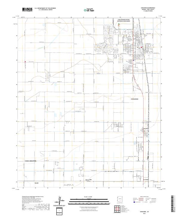
2021 Map of Coolidge
USGS Topo · Published 2021About this map
Casa Grande Ruins National Monument anchors the northern portion of this Pinal County landscape, preserving the ancestral Sonoran Desert people's architecture just north of the expanding Coolidge city grid. The map illustrates a highly organized agricultural and residential layout, where water management is central to the desert economy. This is evidenced by the S Side Canal and the Pima Lateral, which distribute water across the flat terrain. Beyond the main hub of Coolidge, smaller settlements such as Randolph and La Palma appear along the north-south transit corridors, while Eleven Mile Corner marks a distinct crossroads. The natural drainage of McClellan Wash provides a stark contrast to the rigid geometry of the surrounding road networks and irrigation channels that have reshaped this arid environment.
Find a feature on this map
122 named features on this map. Tap any name to fly to it.
Don’t see what you’re looking for? This feature index may not catch every label — zoom into the map to look around manually.
Map Details
Editions of this 2021 Coolidge Map
This is the sole edition of this map. No revisions or reprints were ever made.
Other maps of this area

1900 · Florence
USGS Topo · 1:125,000

1902 · Florence
USGS Topo · 1:125,000

1907 · Sacaton
USGS Topo · 1:62,500

1922 · Red Rock No 2
USGS Topo · 1:48,000

1922 · Signal Peak
USGS Topo · 1:62,500

1924 · Signal Peak
USGS Topo · 1:62,500

1934 · Newman Peak
USGS Topo · 1:125,000

1954 · Mesa
USGS Topo · 1:250,000

1956 · Tucson
USGS Topo · 1:250,000

1957 · Mesa
USGS Topo · 1:250,000