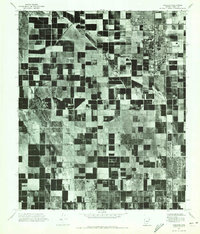
1971 Map of Coolidge
USGS Topo · Published 1972About this map
Coolidge and the surrounding Pinal County agricultural landscape are captured in this 1971 orthophotomosaic, showing a meticulously gridded pattern of irrigated fields and desert reaches. The aerial imagery highlights the contrast between the concentrated residential and commercial blocks of Coolidge in the northeast and the smaller, unincorporated settlements of Randolph and Eleven Mile Corner to the south. This specific type of survey, using photogrammetric methods, reveals the exact footprint of desert agriculture and road development in the early 1970s. The dense patchwork of fields suggests a region defined by large-scale water management and farming, with clear divisions between cultivated land and the native desert scrub, providing a precise spatial record of the area's mid-century expansion.
Find a feature on this map
3 named features on this map. Tap any name to fly to it.
Don’t see what you’re looking for? This feature index may not catch every label — zoom into the map to look around manually.
Map Details
Editions of this 1971 Coolidge Map
This is the sole edition of this map. No revisions or reprints were ever made.
Other maps of this area

1900 · Florence
USGS Topo · 1:125,000

1902 · Florence
USGS Topo · 1:125,000

1907 · Sacaton
USGS Topo · 1:62,500

1922 · Red Rock No 2
USGS Topo · 1:48,000

1922 · Signal Peak
USGS Topo · 1:62,500

1924 · Signal Peak
USGS Topo · 1:62,500

1934 · Newman Peak
USGS Topo · 1:125,000

1954 · Mesa
USGS Topo · 1:250,000

1956 · Tucson
USGS Topo · 1:250,000

1957 · Mesa
USGS Topo · 1:250,000