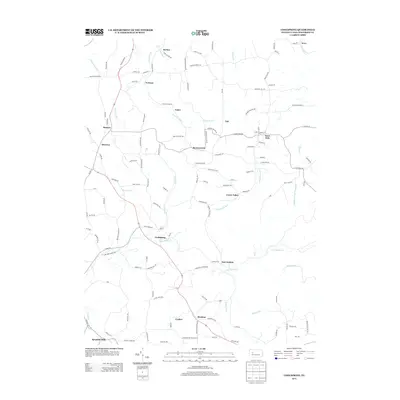
2013 Map of Coolspring
USGS Topo · Published 2013About this map
Coolspring and its surrounding hamlets in McCalmont Township are defined by a dense network of watercourses and winding valley roads. The landscape is deeply carved by drainage systems including Little Sandy Cr, Fivemile Run, and Indiancamp Run, which historically dictated the placement of small settlements and transportation corridors. Several distinct clusters of residence and commerce appear, such as Knox Dale in the northeast and Ramsaytown near the center, connected by roads that often follow the natural contours of the hollows.
Find a feature on this map
129 named features on this map. Tap any name to fly to it.
Don’t see what you’re looking for? This feature index may not catch every label — zoom into the map to look around manually.
Map Details
Editions of this 2013 Coolspring Map
This is the sole edition of this map. No revisions or reprints were ever made.
Other maps of this area

1906 · Punxsutawney
USGS Topo · 1:62,500

1909 · Smicksburg
USGS Topo · 1:62,500

1922 · Du Bois
USGS Topo · 1:62,500

1924 · Du Bois
USGS Topo · 1:62,500

1924 · Brookville
USGS Topo · 1:62,500

1926 · Brookville
USGS Topo · 1:62,500

1938 · Smicksburg
USGS Topo · 1:62,500

1939 · Smicksburg
USGS Topo · 1:62,500

1939 · Punxsutawney
USGS Topo · 1:62,500

1942 · Punxsutawney
USGS Topo · 1:62,500
Featured Places
- McCalmont Township, PA
- Knox Township, PA
- Pine Creek Township, PA
- Colon, Knox Township
- Tait, Knox Township