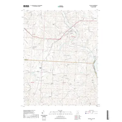
2019 Map of Coolville
USGS Topo · Published 2019About this map
Coolville and its surrounding ridge lands sit near the confluence of the Hocking River and the Ohio River, marking a landscape where topography deeply dictates settlement. This 2019 survey illustrates how the high ground of Brimstone Ridge, Heiney Ridge, and Limberger Ridge continues to host the primary roads and communities, away from the winding creek beds of Wolfpen Cr and Fourmile Creek. The map is particularly valuable for genealogical research, documenting numerous small burial sites including Old Coolville Cem, Fairview Cem, and White Chapel Cem. Along the western edge, Tuppers Plains and the recreation area at Upper Hickory Hills Lake serve as local hubs, while smaller named locales like Pinegrove, Joppa, and Success appear as nodes within the rural network. The border between Athens Co and Meigs Co runs through the southern half of the sheet, while the Ohio River forms the state boundary with West Virginia.
Find a feature on this map
145 named features on this map. Tap any name to fly to it.
Don’t see what you’re looking for? This feature index may not catch every label — zoom into the map to look around manually.
Map Details
Editions of this 2019 Coolville Map
This is the sole edition of this map. No revisions or reprints were ever made.
Other maps of this area

1902 · Parkersburg
USGS Topo · 1:62,500

1904 · Parkersburg
USGS Topo · 1:62,500

1904 · Chesterhill
USGS Topo · 1:62,500

1906 · Belleville
USGS Topo · 1:62,500

1906 · Chesterhill
USGS Topo · 1:62,500

1907 · Keno
USGS Topo · 1:62,500

1924 · Belleville
USGS Topo · 1:62,500

1926 · Belleville
USGS Topo · 1:62,500

1949 · Clarksburg
USGS Topo · 1:250,000

1956 · Clarksburg
USGS Topo · 1:250,000