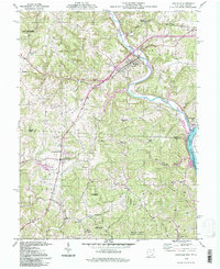
1994 Map of Coolville
USGS Topo · Published 1998About this map
The Hocking River snakes through the borderlands of Athens and Meigs counties before reaching its confluence with the Ohio River at Hockingport. This late-twentieth-century survey documents the rural character of southeastern Ohio, centered on the village of Coolville and the agricultural community of Tuppers Plains. The map reveals a landscape defined by sharp elevation changes, particularly along Limberger Ridge and the wooded tracts of the Shade River State Forest. Cultural sites are well-preserved, from the Carthage-Troy Township Sch to numerous hilltop cemeteries such as Vanderhoof Cem and Lyndon Cem. The region's conservation history is also evident, featuring the Marie J Desonier State Nature Preserve and a network of named runs like Skunk Run and Indian Run that feed the major river systems.
Find a feature on this map
56 named features on this map. Tap any name to fly to it.
Don’t see what you’re looking for? This feature index may not catch every label — zoom into the map to look around manually.
Map Details
Editions of this 1994 Coolville Map
This is the sole edition of this map. No revisions or reprints were ever made.
Other maps of this area

1902 · Parkersburg
USGS Topo · 1:62,500

1904 · Parkersburg
USGS Topo · 1:62,500

1904 · Chesterhill
USGS Topo · 1:62,500

1906 · Belleville
USGS Topo · 1:62,500

1906 · Chesterhill
USGS Topo · 1:62,500

1907 · Keno
USGS Topo · 1:62,500

1924 · Belleville
USGS Topo · 1:62,500

1926 · Belleville
USGS Topo · 1:62,500

1949 · Clarksburg
USGS Topo · 1:250,000

1956 · Clarksburg
USGS Topo · 1:250,000