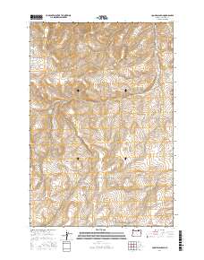
2017 Map of Coombs Canyon
USGS Topo · Published 2017About this map
Coombs Canyon and Mud Spring Canyon carve through this section of Umatilla County, defining a landscape marked by significant elevation changes and deep drainage basins. The area is dominated by the transition between several public land survey townships, including t2n r31e, t1n r31e, and t1s r31e. Settlement patterns are traced through a network of rural roads often bearing the names of local families, such as Redwine Rd, Reinhart Rd, and Hoeft Rd. Water sources are vital in this high-desert environment, evidenced by the named Crazy John Spring and the presence of numerous canyons. This 2017 survey illustrates the modern configuration of access roads like Speare Canyon Rd and Stock Dr Rd as they navigate the ridges and valleys of the region south of the Columbia River plateau.
Find a feature on this map
19 named features on this map. Tap any name to fly to it.
Don’t see what you’re looking for? This feature index may not catch every label — zoom into the map to look around manually.
Map Details
Editions of this 2017 Coombs Canyon Map
This is the sole edition of this map. No revisions or reprints were ever made.
Other maps of this area

1908 · Umatilla
USGS Topo · 1:125,000

1935 · Pendleton
USGS Topo · 1:125,000

1953 · Pendleton
USGS Topo · 1:250,000

1956 · Pendleton
USGS Topo · 1:250,000

1966 · Mc Kay Reservoir
USGS Topo · 1:24,000

1966 · Pendleton
USGS Topo · 1:24,000
1966 · Barnhart
USGS Topo · 1:24,000
1966 · Coombs Canyon
USGS Topo · 1:24,000

1967 · Nye
USGS Topo · 1:24,000

1967 · Pilot Rock
USGS Topo · 1:24,000