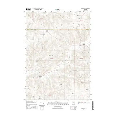
2015 Map of Coon Valley
USGS Topo · Published 2015About this map
Coon Valley and Chaseburg anchor a landscape defined by narrow coulees and prominent ridges along the La Crosse and Vernon County border. This area showcases the classic Driftless Area topography, where the drainage of Coon Creek and its tributaries like Hasley Creek have carved deep valleys into the plateau. The map reveals a high concentration of named physical features that reflect family settlement and local geography, such as Kreibich Coulee, Roesler Coulee, and Hohlfeld Coulee. Cultural markers like Hellwig Cem and Krause Cem are situated on the higher ground of Brinkman Ridge and the North Chipmunk Coulee area, indicating historical burial sites away from the flood-prone valley floors. The road network, including County Highway NN and County Road N, follows the meandering paths of the hollows or tracks along the crests of Misha Ridge and Gronvold Ridge.
Find a feature on this map
94 named features on this map. Tap any name to fly to it.
Don’t see what you’re looking for? This feature index may not catch every label — zoom into the map to look around manually.
Map Details
Editions of this 2015 Coon Valley Map
This is the sole edition of this map. No revisions or reprints were ever made.
Other maps of this area

1909 · Sparta
USGS Topo · 1:62,500

1923 · Viroqua
USGS Topo · 1:62,500

1926 · Stoddard
USGS Topo · 1:62,500

1926 · Viroqua
USGS Topo · 1:62,500

1927 · La Crosse
USGS Topo · 1:62,500

1930 · La Crosse
USGS Topo · 1:62,500

1947 · Sparta
USGS Topo · 1:62,500

1949 · Sparta
USGS Topo · 1:62,500

1958 · La Crosse
USGS Topo · 1:250,000

1961 · La Crosse
USGS Topo · 1:250,000