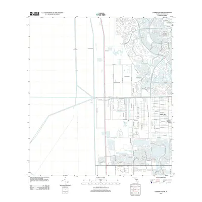
2012 Map of Cooper City SW
USGS Topo · Published 2012About this map
S New River Canal and a complex system of water management structures define this landscape on the edge of the Everglades, where suburban expansion meets the conservation levee system. The western portion of the area is dominated by the vast open tracts bounded by Levee Number 68A and Levee Number 37, representing the sharp boundary between South Florida's built environment and its managed wetlands. To the east, the residential growth of the early 21st century is evident in the dense street networks of Rolling Oaks and neighborhoods organized around Glades Pkwy and Bonaventure Blvd. Local aviation history is marked by private facilities like Saints Airfield and the uniquely named Mac-Ivor & Friends Airstrip, which sit alongside the primary drainage arteries like L-68-A.
Find a feature on this map
108 named features on this map. Tap any name to fly to it.
Don’t see what you’re looking for? This feature index may not catch every label — zoom into the map to look around manually.
Map Details
Editions of this 2012 Cooper City SW Map
This is the sole edition of this map. No revisions or reprints were ever made.
Other maps of this area

1949 · Opalocka
USGS Topo · 1:24,000

1956 · Miami
USGS Topo · 1:250,000

1956 · West Palm Beach
USGS Topo · 1:250,000

1957 · West Palm Beach
USGS Topo · 1:250,000

1958 · West Palm Beach
USGS Topo · 1:250,000

1958 · Miami
USGS Topo · 1:250,000

1962 · Opa-locka
USGS Topo · 1:24,000

1963 · Andytown
USGS Topo · 1:24,000

1963 · Pennsuco
USGS Topo · 1:24,000

1963 · Cooper City SW
USGS Topo · 1:24,000