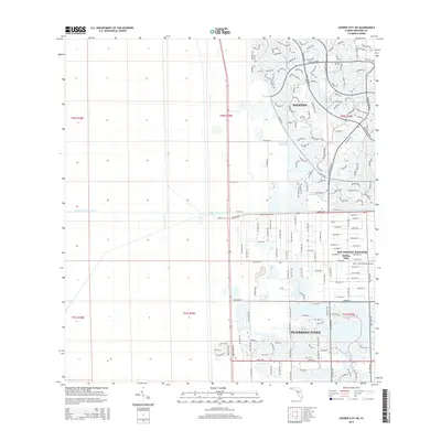
2015 Map of Cooper City SW
USGS Topo · Published 2015About this map
The master-planned community of Weston and the suburban expanse of Pembroke Pines dominate this 2015 landscape, showcasing the rapid residential development of western Broward County. The map captures a transition from the dense street grids of Pembroke Pines to the more expansive equestrian-oriented lots of Southwest Ranches and the Rolling Oaks neighborhood. Infrastructure plays a critical role in the region's geography, with the South New River Canal cutting east-to-west across the terrain and major thoroughfares like Pines Blvd and Sheridan St providing the framework for commercial and residential growth. Notably, the private Mac-Ivor & Friends Airstrip is situated just south of Stirling Rd, a distinct landmark amidst the encroaching suburban sprawl. The map also delineates the Public Land Survey System township and range lines, such as t50s r39e, which guided the original drainage and development of this former wetland area.
Find a feature on this map
51 named features on this map. Tap any name to fly to it.
Don’t see what you’re looking for? This feature index may not catch every label — zoom into the map to look around manually.
Map Details
Editions of this 2015 Cooper City SW Map
This is the sole edition of this map. No revisions or reprints were ever made.
Other maps of this area

1949 · Opalocka
USGS Topo · 1:24,000

1956 · Miami
USGS Topo · 1:250,000

1956 · West Palm Beach
USGS Topo · 1:250,000

1957 · West Palm Beach
USGS Topo · 1:250,000

1958 · West Palm Beach
USGS Topo · 1:250,000

1958 · Miami
USGS Topo · 1:250,000

1962 · Opa-locka
USGS Topo · 1:24,000

1963 · Andytown
USGS Topo · 1:24,000

1963 · Pennsuco
USGS Topo · 1:24,000

1963 · Cooper City SW
USGS Topo · 1:24,000