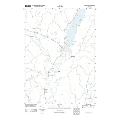
2010 Map of Cooperstown
USGS Topo · Published 2010About this map
Otsego Lake serves as the focal point of this central New York landscape, marking the headwaters where the Susquehanna River begins its long journey south. The village of Cooperstown is situated at the foot of the lake, surrounded by smaller crossroad settlements like Fly Creek, Toddsville, and Bowerstown. The geography is defined by narrow valleys and significant ridges, including Panther Mountain and Murphy Hill, which funnel local drainage through Oaks Creek and Cherry Valley Creek.
Find a feature on this map
72 named features on this map. Tap any name to fly to it.
Don’t see what you’re looking for? This feature index may not catch every label — zoom into the map to look around manually.
Map Details
Editions of this 2010 Cooperstown Map
This is the sole edition of this map. No revisions or reprints were ever made.
Other maps of this area

1903 · Richfield Springs
USGS Topo · 1:62,500

1907 · Winfield
USGS Topo · 1:62,500

1907 · Cooperstown
USGS Topo · 1:62,500

1909 · Cooperstown
USGS Topo · 1:62,500

1910 · Hartwick
USGS Topo · 1:62,500

1912 · Hartwick
USGS Topo · 1:62,500

1943 · Schuyler Lake
USGS Topo · 1:24,000

1943 · Mt Vision
USGS Topo · 1:24,000

1943 · Milford
USGS Topo · 1:24,000

1943 · Richfield Springs
USGS Topo · 1:24,000