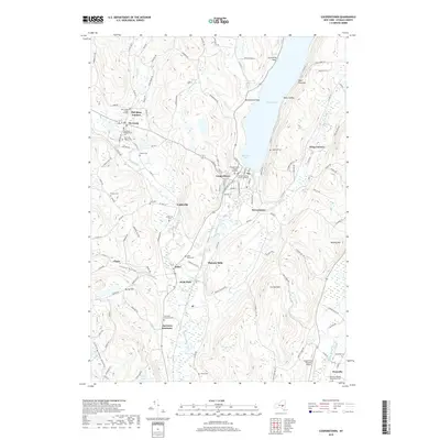
2019 Map of Cooperstown
USGS Topo · Published 2019About this map
Otsego Lake serves as the headwaters of the Susquehanna River, which winds southward past Cooperstown and through a landscape defined by historic mill sites and agricultural hamlets. The village is flanked by prominent points such as Brookwood Point and Threemile Point, while the surrounding hills are dotted with family and church burying grounds. Genealogists will find a wealth of local history in sites like the Old Chapel Burial Ground at Pail Shop Corners and the Westville Baptist Churchyard Cem further south.
Find a feature on this map
135 named features on this map. Tap any name to fly to it.
Don’t see what you’re looking for? This feature index may not catch every label — zoom into the map to look around manually.
Map Details
Editions of this 2019 Cooperstown Map
This is the sole edition of this map. No revisions or reprints were ever made.
Other maps of this area

1903 · Richfield Springs
USGS Topo · 1:62,500

1907 · Winfield
USGS Topo · 1:62,500

1907 · Cooperstown
USGS Topo · 1:62,500

1909 · Cooperstown
USGS Topo · 1:62,500

1910 · Hartwick
USGS Topo · 1:62,500

1912 · Hartwick
USGS Topo · 1:62,500

1943 · Schuyler Lake
USGS Topo · 1:24,000

1943 · Mt Vision
USGS Topo · 1:24,000

1943 · Milford
USGS Topo · 1:24,000

1943 · Richfield Springs
USGS Topo · 1:24,000