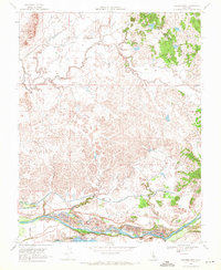
1968 Map of Cooperstown
USGS Topo · Published 1971About this map
The Sierra RR cuts across the northern landscape of this map, passing through the small settlements of Warnerville and Cooperstown as it navigates the Sierra Nevada Foothills. This late-1960s survey documents a region defined by its water management and agricultural infrastructure, most notably the extensive Modesto Main Canal and Modesto Lower Main Canal systems that draw from the Tuolumne River. Along the riverbanks, significant Dredge Tailings reveal the area's industrial mining history, while the southern boundary is anchored by the recreational and ecological expanse of Turlock Lake and Turlock Lake State Park. Local life is anchored by landmarks such as the Roberts Ferry Sch and several small rural Cem sites, providing valuable geographic points for genealogists tracing families in these foothills east of Waterford.
Find a feature on this map
24 named features on this map. Tap any name to fly to it.
Don’t see what you’re looking for? This feature index may not catch every label — zoom into the map to look around manually.
Map Details
Editions of this 1968 Cooperstown Map
3 editions found
Other maps of this area

1893 · Sonora
USGS Topo · 1:125,000

1896 · Sonora
USGS Topo · 1:125,000

1897 · Sonora
USGS Topo · 1:125,000

1898 · Sonora
USGS Topo · 1:125,000

1913 · Dickenson
USGS Topo · 1:31,680

1915 · Paulsell
USGS Topo · 1:31,680

1915 · La Grange
USGS Topo · 1:24,000

1916 · Three Tree Flat
USGS Topo · 1:31,680

1916 · Montpellier
USGS Topo · 1:31,680

1916 · Cooperstown
USGS Topo · 1:31,680