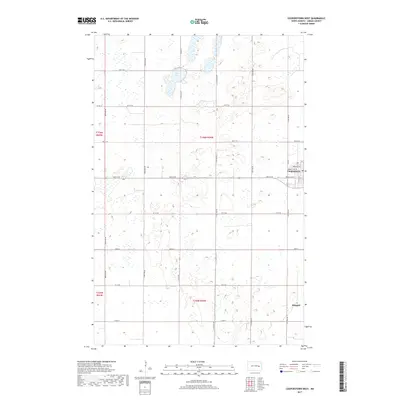
2017 Map of Cooperstown West
USGS Topo · Published 2017About this map
Cooperstown marks the primary center of activity in this section of Griggs County, with its residential grid extending along Park Ave NW and Rollin Ave SW. The surrounding landscape is defined by the high density of prairie potholes and small wetlands, which characteristic of the North Dakota drift prairie. To the south, the smaller settlement of Shepard sits near the intersection of several section-line roads, while Lake Five serves as a prominent landmark in the north. The survey illustrates the rigid organization of the rural landscape, dictated by the Public Land Survey System through townships like t146n r59w. A network of county roads, including Co Rd 22 and Co Rd 15, connects isolated farmsteads and agricultural plots across the undulating terrain.
Find a feature on this map
31 named features on this map. Tap any name to fly to it.
Don’t see what you’re looking for? This feature index may not catch every label — zoom into the map to look around manually.
Map Details
Editions of this 2017 Cooperstown West Map
This is the sole edition of this map. No revisions or reprints were ever made.
Other maps of this area

1952 · New Rockford
USGS Topo · 1:250,000

1956 · New Rockford
USGS Topo · 1:250,000

1961 · Binford
USGS Topo · 1:24,000

1961 · Cooperstown East
USGS Topo · 1:24,000

1961 · Jessie
USGS Topo · 1:24,000

1961 · Revere
USGS Topo · 1:24,000

1961 · Hannaford
USGS Topo · 1:24,000

1961 · Cooperstown West
USGS Topo · 1:24,000

1961 · Sutton NE
USGS Topo · 1:24,000

1961 · Karnak
USGS Topo · 1:24,000