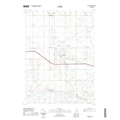
2019 Map of Coopersville
USGS Topo · Published 2019About this map
The Grand River snakes through the southern portion of this Michigan landscape, anchoring the historic riverside settlements of Lamont and Eastmanville. This 2019 survey documents a region defined by its transition from fertile river bottoms to the growing municipal center of Coopersville. The map captures a high density of genealogical landmarks, particularly along the river corridor, where Maplewood Cem, Elmwood Cem, and the Eastmanville Cem are situated. To the north, the terrain is drained by tributaries like Deer Cr and Stott and Tanper Drain, which carve through the rural stretches between Dennison and the Muskegon County line. The settlement pattern follows a clear progression from the older water-based commerce along Leonard St to the modern residential development and industrial presence concentrated near the Po and school campuses in the heart of Coopersville.
Find a feature on this map
55 named features on this map. Tap any name to fly to it.
Don’t see what you’re looking for? This feature index may not catch every label — zoom into the map to look around manually.
Map Details
Editions of this 2019 Coopersville Map
This is the sole edition of this map. No revisions or reprints were ever made.
Other maps of this area

1929 · Holland
USGS Topo · 1:62,500

1930 · Muskegon
USGS Topo · 1:62,500

1932 · Holland
USGS Topo · 1:62,500

1936 · Muskegon
USGS Topo · 1:62,500

1945 · Ravenna
USGS Topo · 1:62,500

1954 · Milwaukee
USGS Topo · 1:250,000

1954 · Midland
USGS Topo · 1:250,000

1958 · Midland
USGS Topo · 1:250,000

1958 · Milwaukee
USGS Topo · 1:250,000

1958 · Allendale
USGS Topo · 1:24,000