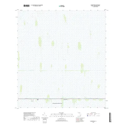
2018 Map of Coopertown
USGS Topo · Published 2018About this map
The Everglades landscape dominates this 2018 survey, illustrating the managed intersection of wild marshland and South Florida infrastructure. The southern portion of the sheet is bisected by 8th St SW, which runs parallel to the Tamiami Canal Number C-4, a critical component of the region's complex water management system. Along this corridor, the small settlements of Coopertown and Frog City provide human anchors in an area otherwise defined by the expansive Everglades National Park. Further north, the presence of the Agricultural Canal and the distinctively named area known as The Pocket highlight how drainage and canalization have historically shaped the terrain. The map serves as a contemporary record of this fragile environment, documenting the persistent boundaries between conservation land and the vital transportation arteries connecting Miami to the west.
Find a feature on this map
8 named features on this map. Tap any name to fly to it.
Don’t see what you’re looking for? This feature index may not catch every label — zoom into the map to look around manually.
Map Details
Editions of this 2018 Coopertown Map
This is the sole edition of this map. No revisions or reprints were ever made.
Other maps of this area

1949 · South Miami NW
USGS Topo · 1:24,000

1955 · South Miami NW
USGS Topo · 1:24,000

1956 · Miami
USGS Topo · 1:250,000

1958 · Miami
USGS Topo · 1:250,000

1963 · Pennsuco
USGS Topo · 1:24,000

1972 · Chekika Island
USGS Topo · 1:24,000

1972 · South Of Coopertown
USGS Topo · 1:24,000

1973 · Custard Apple Hammock
USGS Topo · 1:24,000

1973 · West Of Pennsuco
USGS Topo · 1:24,000

1973 · Long Island
USGS Topo · 1:24,000