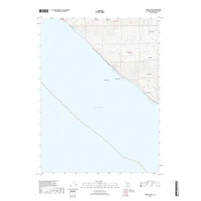
2018 Map of Cooskie Creek
USGS Topo · Published 2018About this map
Johnny Jack Ridge and Cooskie Ridge dominate this coastal stretch of Humboldt County, where the land drops precipitously into the Pacific Ocean. This 2018 survey reveals a landscape defined by sharp elevation changes and numerous drainage systems, including Cooskie Cr and Randall Cr. Named topographical landmarks like Sea Lion Gulch and Spanish Flat indicate a history of local maritime and terrestrial identification along this largely inaccessible shoreline. Offshore features such as Rodgers Break and Reynolds Rock serve as vital navigation points where the mountains meet the sea. The map illustrates the complex ridgelines of Lake Ridge and Spanish Ridge, providing a clear view of the natural barriers that have historically limited coastal development in this part of Northern California.
Find a feature on this map
17 named features on this map. Tap any name to fly to it.
Don’t see what you’re looking for? This feature index may not catch every label — zoom into the map to look around manually.
Map Details
Editions of this 2018 Cooskie Creek Map
This is the sole edition of this map. No revisions or reprints were ever made.
Other maps of this area

1919 · Glynn
USGS Topo · 1:62,500

1920 · Pt. Delagda
USGS Topo · 1:62,500

1921 · Cape Mendocino
USGS Topo · 1:62,500

1926 · Gorda
USGS Topo · 1:62,500

1949 · Eureka
USGS Topo · 1:250,000

1949 · Point Delgada
USGS Topo · 1:62,500

1950 · Cape Mendocino
USGS Topo · 1:62,500

1950 · Scotia
USGS Topo · 1:62,500

1951 · Scotia
USGS Topo · 1:62,500

1951 · Point Delgada
USGS Topo · 1:62,500