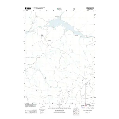
2012 Map of Copco
USGS Topo · Published 2012About this map
Copco Lake, an impoundment of the Klamath River, dominates this mountainous landscape in northern Siskiyou County. The small community of Copco sits at the river's entry to the reservoir, near the Fall Creek Fish Hatchery and the base of Sloan Butte. The terrain is marked by a network of steep canyons and timbered heights, including Daggett Mountain and Bloomingcamp Peak. Historically significant watering points and small-scale settlements are scattered throughout the backcountry, such as Frame Mill Spring, Soda Spring, and the JJJ Ranch. Higher elevations are monitored from the Lakeview Lookout, while roads like the Ager-Beswick Rd provide access to the remote interior. The presence of features like Surveyors Glade and Bogus Burn suggests a landscape defined by its forestry history and rugged volcanic geography north of the Klamath Rim.
Find a feature on this map
50 named features on this map. Tap any name to fly to it.
Don’t see what you’re looking for? This feature index may not catch every label — zoom into the map to look around manually.
Map Details
Editions of this 2012 Copco Map
This is the sole edition of this map. No revisions or reprints were ever made.
Other maps of this area

1886 · Shasta
USGS Topo · 1:250,000

1891 · Ashland
USGS Topo · 1:250,000

1893 · Ashland
USGS Topo · 1:250,000

1894 · Shasta
USGS Topo · 1:250,000

1897 · Ashland
USGS Topo · 1:250,000

1922 · Shasta Valley Sheet No 13
USGS Topo · 1:24,000

1922 · Shasta Valley Sheet No 16
USGS Topo · 1:24,000

1934 · Macdoel
USGS Topo · 1:96,000

1941 · Macdoel
USGS Topo · 1:125,000

1948 · Weed
USGS Topo · 1:250,000