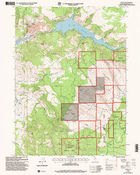
2001 Map of Copco
USGS Topo · Published 2004About this map
The Klamath River corridor dominates this Siskiyou County landscape, defined by the industrial and utility infrastructure surrounding Copco Lake. The settlement of Copco serves as a hub for local operations, including the Fall Creek Powerhouse and the Fall Creek Fish Hatchery, while the nearby Fall Creek School points to the residential history of the power company workers and their families. Further downstream, the waters flow into the Iron Gate Reservoir, which is navigated via an aqueduct system.
Find a feature on this map
53 named features on this map. Tap any name to fly to it.
Don’t see what you’re looking for? This feature index may not catch every label — zoom into the map to look around manually.
Map Details
Editions of this 2001 Copco Map
This is the sole edition of this map. No revisions or reprints were ever made.
Other maps of this area

1886 · Shasta
USGS Topo · 1:250,000

1891 · Ashland
USGS Topo · 1:250,000

1893 · Ashland
USGS Topo · 1:250,000

1894 · Shasta
USGS Topo · 1:250,000

1897 · Ashland
USGS Topo · 1:250,000

1922 · Shasta Valley Sheet No 13
USGS Topo · 1:24,000

1922 · Shasta Valley Sheet No 16
USGS Topo · 1:24,000

1934 · Macdoel
USGS Topo · 1:96,000

1941 · Macdoel
USGS Topo · 1:125,000

1948 · Weed
USGS Topo · 1:250,000