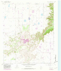
1965 Map of Cope Creek
USGS Topo · Published 1982About this map
Mackenzie Reservoir and its surrounding canyonlands dominate this 1960s landscape along the border of Swisher and Briscoe counties. The map captures the rugged drainage patterns where Tule Creek and Rock Creek carve deep into the High Plains escarpment, leading toward the dramatic topographic feature known as The Narrows. While much of the upland is marked by scattered depressions and ranching operations like Flowers Ranch and Mayfield Ranch, the canyon floors reveal a more complex network of springs and seasonal water sources.
Find a feature on this map
19 named features on this map. Tap any name to fly to it.
Don’t see what you’re looking for? This feature index may not catch every label — zoom into the map to look around manually.
Map Details
Editions of this 1965 Cope Creek Map
2 editions found
Other maps of this area

1954 · Plainview
USGS Topo · 1:250,000

1958 · Plainview
USGS Topo · 1:250,000

1965 · Ross Canyon
USGS Topo · 1:24,000

1965 · Big Betty Reservoir
USGS Topo · 1:24,000

1965 · Silverton
USGS Topo · 1:24,000

1965 · Rock Creek
USGS Topo · 1:24,000

1965 · Vigo Park
USGS Topo · 1:24,000

1965 · Cope Creek
USGS Topo · 1:24,000

1969 · Love
USGS Topo · 1:24,000

1969 · Jackson Hill
USGS Topo · 1:24,000