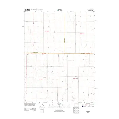
2013 Map of Cope SE
USGS Topo · Published 2013About this map
The High Plains of Eastern Colorado are defined here by a rigid grid of section lines and county boundaries where Washington, Yuma, and Kit Carson counties meet. This survey captures a landscape dominated by large-scale agricultural divisions, segmented by an extensive network of rural routes such as Co Road RR and Co Road 59. The geometric precision of the Public Land Survey System is evident in the townships of t005s r049w and t006s r048w, which organize the rolling terrain into productive parcels.
Find a feature on this map
30 named features on this map. Tap any name to fly to it.
Don’t see what you’re looking for? This feature index may not catch every label — zoom into the map to look around manually.
Map Details
Editions of this 2013 Cope SE Map
This is the sole edition of this map. No revisions or reprints were ever made.
Other maps of this area

1954 · Limon
USGS Topo · 1:250,000

1957 · Limon
USGS Topo · 1:250,000

1958 · Limon
USGS Topo · 1:250,000

1968 · Joes
USGS Topo · 1:24,000

1977 · Cope
USGS Topo · 1:24,000

1977 · Cope SE
USGS Topo · 1:24,000

1977 · Cope SW
USGS Topo · 1:24,000
1978 · Cope NW
USGS Topo · 1:24,000
1978 · Joes SW
USGS Topo · 1:24,000

1979 · Seibert NE
USGS Topo · 1:24,000