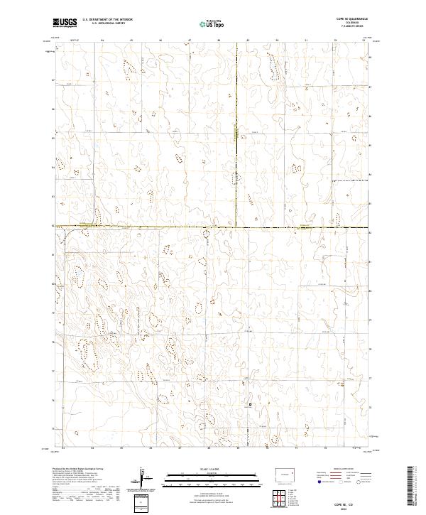
2022 Map of Cope SE
USGS Topo · Published 2022About this map
The intersection of Kit Carson, Washington, and Yuma counties defines this prairie landscape in Eastern Colorado. The terrain is characterized by a high-plains grid system, where the surveyor's precision is visible in the alignment of section lines and the rectangular network of rural routes. Smit Cem, located in the southeastern quadrant near Co Rd 19 and Co Rd Ll, serves as a localized focal point for genealogical interest in an area otherwise dominated by open range and agricultural parcels. The boundary between Washington and Yuma counties runs vertically through the center, illustrating how modern political divisions overlay the natural contours of the land. This survey provides an essential view of the sparse infrastructure and land-management patterns common to the High Plains during the early twenty-first century.
Find a feature on this map
28 named features on this map. Tap any name to fly to it.
Don’t see what you’re looking for? This feature index may not catch every label — zoom into the map to look around manually.
Map Details
Editions of this 2022 Cope SE Map
This is the sole edition of this map. No revisions or reprints were ever made.
Other maps of this area

1954 · Limon
USGS Topo · 1:250,000

1957 · Limon
USGS Topo · 1:250,000

1958 · Limon
USGS Topo · 1:250,000

1968 · Joes
USGS Topo · 1:24,000

1977 · Cope
USGS Topo · 1:24,000

1977 · Cope SE
USGS Topo · 1:24,000

1977 · Cope SW
USGS Topo · 1:24,000
1978 · Cope NW
USGS Topo · 1:24,000
1978 · Joes SW
USGS Topo · 1:24,000

1979 · Seibert NE
USGS Topo · 1:24,000