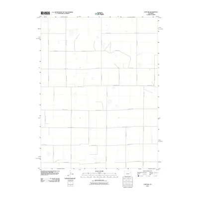
2010 Map of Cope SW
USGS Topo · Published 2010About this map
Kit Carson County's agricultural landscape is defined by a rigorous grid of section lines and gravel thoroughfares, as documented in this 2010 U.S. Geological Survey study. The terrain is dominated by high-plains geography, where the orderly arrangement of County Rd-1 and County Rd-10 facilitates movement across a vast expanse of farm and ranch land. Notable corridors like County Hwy RR and County Road KK serve as the primary arteries connecting these isolated homesteads and work sites. The mapping of these routes, from County Road MM to County Road NN, illustrates the enduring importance of the Jeffersonian survey system in shaping the development and navigation of eastern Colorado's rural interior. This edition provides a precise view of the local infrastructure before subsequent decades of change, highlighting the essential network of named county roads that sustain the region's economy.
Find a feature on this map
21 named features on this map. Tap any name to fly to it.
Don’t see what you’re looking for? This feature index may not catch every label — zoom into the map to look around manually.
Map Details
Editions of this 2010 Cope SW Map
This is the sole edition of this map. No revisions or reprints were ever made.
Other maps of this area

1954 · Limon
USGS Topo · 1:250,000

1957 · Limon
USGS Topo · 1:250,000

1958 · Limon
USGS Topo · 1:250,000

1977 · Cope
USGS Topo · 1:24,000

1977 · Cope SE
USGS Topo · 1:24,000

1977 · Arickaree
USGS Topo · 1:24,000

1977 · Anton SE
USGS Topo · 1:24,000

1977 · Cope SW
USGS Topo · 1:24,000
1978 · Cope NW
USGS Topo · 1:24,000

1979 · Seibert NE
USGS Topo · 1:24,000