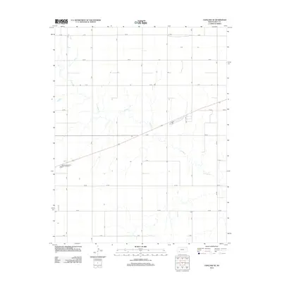
2012 Map of Copeland SE
USGS Topo · Published 2012About this map
Crooked Cr meanders across this rural expanse of Gray County, Kansas, cutting through a landscape organized by a strict geometric grid of section roads. The map reveals the agricultural character of the region, where north-south thoroughfares like Fry Rd and east-west routes such as Aa Rd and Ii Rd define property boundaries and transport lanes. The primary modern infrastructure in this area includes the Copeland Wastewater Treatment Facility, located near the western edge. This survey provides a clear view of the prairie's drainage patterns and the persistent influence of the Public Land Survey System on local development. Researchers will find the exact alignment of numerous rural roads, from Bb Rd to Hh Rd, which serve as the lifelines for this farming community.
Find a feature on this map
19 named features on this map. Tap any name to fly to it.
Don’t see what you’re looking for? This feature index may not catch every label — zoom into the map to look around manually.
Map Details
Editions of this 2012 Copeland SE Map
This is the sole edition of this map. No revisions or reprints were ever made.
Other maps of this area

1892 · Meade
USGS Topo · 1:125,000

1892 · Dodge
USGS Topo · 1:125,000

1896 · Garden
USGS Topo · 1:125,000

1955 · Dodge City
USGS Topo · 1:250,000

1958 · Dodge City
USGS Topo · 1:250,000

1959 · Dodge City
USGS Topo · 1:250,000

1967 · Plains NE
USGS Topo · 1:24,000

1968 · Montezuma
USGS Topo · 1:24,000

1968 · Montezuma NW
USGS Topo · 1:24,000

1968 · Plains NW
USGS Topo · 1:24,000