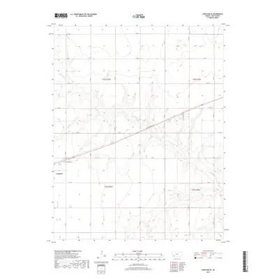
2018 Map of Copeland SE
USGS Topo · Published 2018About this map
The settlement of Copeland anchors the western edge of this High Plains landscape in Gray County, where the topography is defined by the winding course of Crooked Cr. The survey illustrates a highly organized township and range grid, where section lines are traced by an extensive network of local routes such as AA Rd, EE Rd, and Co Rd 7. This drainage pattern suggests a reliance on the creek’s basin for regional hydrology amidst the surrounding agricultural squares. Genealogists and local historians can locate the Copeland Cem just east of the main townsite, providing a specific point of interest for family research. The map also delineates the jurisdictional boundaries of T28s R30w and T28s R29w, showing how the land was partitioned for development and farming in this part of Kansas.
Find a feature on this map
22 named features on this map. Tap any name to fly to it.
Don’t see what you’re looking for? This feature index may not catch every label — zoom into the map to look around manually.
Map Details
Editions of this 2018 Copeland SE Map
This is the sole edition of this map. No revisions or reprints were ever made.
Other maps of this area

1892 · Meade
USGS Topo · 1:125,000

1892 · Dodge
USGS Topo · 1:125,000

1896 · Garden
USGS Topo · 1:125,000

1955 · Dodge City
USGS Topo · 1:250,000

1958 · Dodge City
USGS Topo · 1:250,000

1959 · Dodge City
USGS Topo · 1:250,000

1967 · Plains NE
USGS Topo · 1:24,000

1968 · Montezuma
USGS Topo · 1:24,000

1968 · Montezuma NW
USGS Topo · 1:24,000

1968 · Plains NW
USGS Topo · 1:24,000