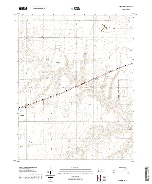
2022 Map of Copeland SE
USGS Topo · Published 2022About this map
Copeland sits at the southwestern edge of this High Plains landscape, where the flat upland terrain is deeply incised by the drainage of Crooked Cr. The map reveals a strictly regulated section-line road network, with routes such as Aa RD and HH RD defining the agricultural grid of Gray County. This 2022 survey captures the modern rural layout, including the Copeland Cem located just north of the town center. The winding path of Crooked Cr creates the only significant relief in an otherwise uniform landscape of township and range divisions, showing how water continues to dictate the local geography even in a region dominated by industrial-scale farming.
Find a feature on this map
22 named features on this map. Tap any name to fly to it.
Don’t see what you’re looking for? This feature index may not catch every label — zoom into the map to look around manually.
Map Details
Editions of this 2022 Copeland SE Map
This is the sole edition of this map. No revisions or reprints were ever made.
Other maps of this area

1892 · Meade
USGS Topo · 1:125,000

1892 · Dodge
USGS Topo · 1:125,000

1896 · Garden
USGS Topo · 1:125,000

1955 · Dodge City
USGS Topo · 1:250,000

1958 · Dodge City
USGS Topo · 1:250,000

1959 · Dodge City
USGS Topo · 1:250,000

1967 · Plains NE
USGS Topo · 1:24,000

1968 · Montezuma
USGS Topo · 1:24,000

1968 · Montezuma NW
USGS Topo · 1:24,000

1968 · Plains NW
USGS Topo · 1:24,000