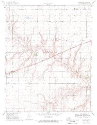
1969 Map of Copeland SE
USGS Topo · Published 1971About this map
Crooked Creek snakes through the central portion of this High Plains landscape, its winding path contrasting with the rigid section lines that define the agricultural surroundings. In the southwest, the town of Copeland serves as a local hub, situated where the Atchison Topeka and Santa Fe railroad cuts diagonally across the township lines. This rail line, paralleled by a major pipeline, illustrates the vital transport and infrastructure corridors connecting these western Kansas communities. The terrain is marked by numerous depressions and subtle drainage patterns, with the townships of Copeland and Montezuma meeting amidst a landscape of scattered water wells and utility lines. This 1969 survey captures the area just as modern infrastructure like the Sewage Disposal Ponds and paved routes 56 and 144 were becoming established fixtures of the local economy.
Find a feature on this map
11 named features on this map. Tap any name to fly to it.
Don’t see what you’re looking for? This feature index may not catch every label — zoom into the map to look around manually.
Map Details
Editions of this 1969 Copeland SE Map
This is the sole edition of this map. No revisions or reprints were ever made.
Other maps of this area

1892 · Meade
USGS Topo · 1:125,000

1892 · Dodge
USGS Topo · 1:125,000

1896 · Garden
USGS Topo · 1:125,000

1955 · Dodge City
USGS Topo · 1:250,000

1958 · Dodge City
USGS Topo · 1:250,000

1959 · Dodge City
USGS Topo · 1:250,000

1967 · Plains NE
USGS Topo · 1:24,000

1968 · Montezuma
USGS Topo · 1:24,000

1968 · Montezuma NW
USGS Topo · 1:24,000

1968 · Plains NW
USGS Topo · 1:24,000