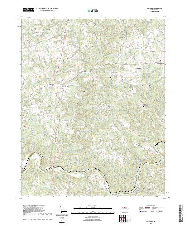
2022 Map of Copeland
USGS Topo · Published 2022About this map
The Yadkin River and Fisher River define the undulating landscape of Surry County in this modern topographic study. The area is characterized by small rural settlements and a significant concentration of community landmarks, particularly churches and family burial grounds like the Stony Knoll Cem and Bear Creek Cem. The settlement at Copeland serves as a local hub, featuring the Copeland School and Copeland Baptist Church.
Find a feature on this map
160 named features on this map. Tap any name to fly to it.
Don’t see what you’re looking for? This feature index may not catch every label — zoom into the map to look around manually.
Map Details
Editions of this 2022 Copeland Map
This is the sole edition of this map. No revisions or reprints were ever made.
Other maps of this area

1891 · Yadkinville
USGS Topo · 1:125,000

1893 · Yadkinville
USGS Topo · 1:125,000

1953 · Winston-Salem
USGS Topo · 1:250,000

1955 · Winston-Salem
USGS Topo · 1:250,000

1962 · Winston-Salem
USGS Topo · 1:250,000

1966 · Yadkinville
USGS Topo · 1:24,000

1966 · East Bend
USGS Topo · 1:24,000
1970 · Siloam
USGS Topo · 1:24,000

1970 · Copeland
USGS Topo · 1:24,000
1970 · Mount Airy South
USGS Topo · 1:24,000