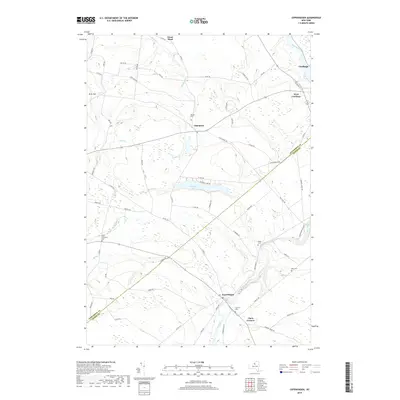
2019 Map of Copenhagen
USGS Topo · Published 2019About this map
The Deer River carves a significant path through this Jefferson and Lewis County borderland, marked by the dramatic drops of Kings Falls and High Falls as the water moves toward Copenhagen. This modern survey reveals a landscape of enduring agricultural patterns and scattered upland settlements. While centers like Carthage and West Carthage anchor the northeastern corner along the Black River, the interior is defined by smaller hamlets such as Champion and Clark Corners. Genealogists will find a high density of rural burial grounds, including the Hillside, South Champion, and Plank cemeteries, which reflect the generations of families that settled this plateau. The presence of Pleasant Lake and numerous tributary creeks like Sandy and Stebbins highlights the region's complex hydrology and its influence on local road networks.
Find a feature on this map
75 named features on this map. Tap any name to fly to it.
Don’t see what you’re looking for? This feature index may not catch every label — zoom into the map to look around manually.
Map Details
Editions of this 2019 Copenhagen Map
This is the sole edition of this map. No revisions or reprints were ever made.
Other maps of this area

1895 · Watertown
USGS Topo · 1:62,500

1898 · Watertown
USGS Topo · 1:62,500

1902 · Carthage
USGS Topo · 1:62,500

1903 · Theresa
USGS Topo · 1:62,500

1904 · Carthage
USGS Topo · 1:62,500

1908 · Watertown
USGS Topo · 1:62,500

1909 · Watertown
USGS Topo · 1:62,500

1911 · Antwerp
USGS Topo · 1:62,500

1942 · Copenhagen
USGS Topo · 1:24,000
1943 · Barnes Corners
USGS Topo · 1:31,680