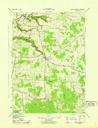
1943 Map of Barnes Corners
USGS Topo · Published 1943About this map
Barnes Corners serves as the central hub of this 1943 survey, marking a significant transition point in the rural landscape of Lewis and Jefferson Counties. The area is defined by a series of deep, narrow ravines known as "gulfs," including the dramatic Inman Gulf, Shingle Gulf, and Bear Gulf. These topographical features dictate the movement of local waterways like Sandy Creek and the Deer River, which carve through the plateau.
Find a feature on this map
38 named features on this map. Tap any name to fly to it.
Don’t see what you’re looking for? This feature index may not catch every label — zoom into the map to look around manually.
Map Details
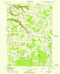
Editions of this 1943 Barnes Corners Map
2 editions found
Other maps of this area

1895 · Watertown
USGS Topo · 1:62,500

1898 · Watertown
USGS Topo · 1:62,500

1902 · Carthage
USGS Topo · 1:62,500

1903 · Orwell
USGS Topo · 1:62,500

1904 · Carthage
USGS Topo · 1:62,500

1905 · Orwell
USGS Topo · 1:62,500

1906 · Highmarket
USGS Topo · 1:62,500

1908 · Watertown
USGS Topo · 1:62,500

1909 · Watertown
USGS Topo · 1:62,500

1942 · Copenhagen
USGS Topo · 1:24,000