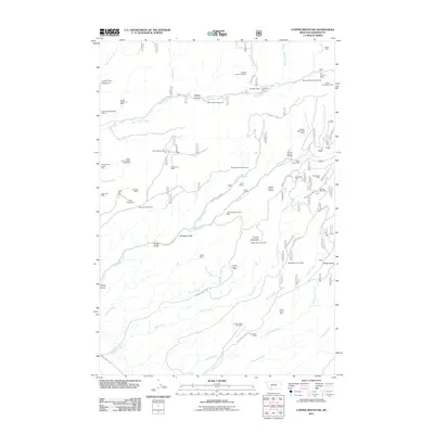
2011 Map of Copper Mountain
USGS Topo · Published 2011About this map
Copper Mountain dominates the center of this Madison County landscape, where the geography is defined by a dense network of high-elevation mining operations and rugged drainage basins. During this era, the mountain's northern and eastern flanks are pocketed with historical workings such as the Paymaster Mine and the Silver Bar Mine. The industrial footprint extends south along the steep banks of Harris Creek, where the Harris Creek Talc Mine and Grandview Mine overlook the deep valley of California Creek.
Find a feature on this map
67 named features on this map. Tap any name to fly to it.
Don’t see what you’re looking for? This feature index may not catch every label — zoom into the map to look around manually.
Map Details
Editions of this 2011 Copper Mountain Map
This is the sole edition of this map. No revisions or reprints were ever made.
Other maps of this area

1888 · Three Forks
USGS Topo · 1:250,000

1893 · Dillon
USGS Topo · 1:250,000

1894 · Three Forks
USGS Topo · 1:250,000

1895 · Three Forks
USGS Topo · 1:250,000

1947 · Bozeman
USGS Topo · 1:250,000

1948 · Bozeman
USGS Topo · 1:250,000

1950 · Harrison
USGS Topo · 1:62,500

1950 · Virginia City
USGS Topo · 1:62,500

1955 · Bozeman
USGS Topo · 1:250,000

1955 · Dillon
USGS Topo · 1:250,000