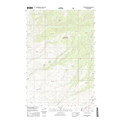
2017 Map of Copper Mountain
USGS Topo · Published 2017About this map
Beaverhead National Forest covers much of this high-elevation terrain in Madison County, where steep drainages and prominent ridges define the landscape. The map highlights a history of mineral exploration and extraction, notably at the Paymaster Mine and throughout named deeps like Australia Gulch and Kings Gulch. Significant peaks and formations, such as Copper Mtn and Peacock Ridge, overlook a complex network of forest access routes including Eclipse Crk Rd and the Bivens Creek Dugway.
Find a feature on this map
38 named features on this map. Tap any name to fly to it.
Don’t see what you’re looking for? This feature index may not catch every label — zoom into the map to look around manually.
Map Details
Editions of this 2017 Copper Mountain Map
This is the sole edition of this map. No revisions or reprints were ever made.
Other maps of this area

1888 · Three Forks
USGS Topo · 1:250,000

1893 · Dillon
USGS Topo · 1:250,000

1894 · Three Forks
USGS Topo · 1:250,000

1895 · Three Forks
USGS Topo · 1:250,000

1947 · Bozeman
USGS Topo · 1:250,000

1948 · Bozeman
USGS Topo · 1:250,000

1950 · Harrison
USGS Topo · 1:62,500

1950 · Virginia City
USGS Topo · 1:62,500

1955 · Bozeman
USGS Topo · 1:250,000

1955 · Dillon
USGS Topo · 1:250,000