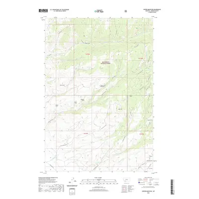
2020 Map of Copper Mountain
USGS Topo · Published 2020About this map
Copper Mtn and the southern reaches of the Tobacco Root Mountains dominate this high-elevation landscape within the Beaverhead National Forest. This terrain is deeply etched by a network of drainage systems, including Bivens Gulch, Donegan Gulch, and Australia Gulch. The prominence of the Paymaster Mine and the naming of nearby gulches suggest a landscape shaped by historical prospecting and extraction. Access to these remote elevations is facilitated by a network of rugged routes such as Bivens Creek Dugway and Ramshorn Creek Rd. Waterways like Ramshorn Cr and California Cr flow through the canyons, while features such as Bridge Canyon and Sand Coulee illustrate the complex erosion patterns of the Madison County high country.
Find a feature on this map
45 named features on this map. Tap any name to fly to it.
Don’t see what you’re looking for? This feature index may not catch every label — zoom into the map to look around manually.
Map Details
Editions of this 2020 Copper Mountain Map
This is the sole edition of this map. No revisions or reprints were ever made.
Other maps of this area

1888 · Three Forks
USGS Topo · 1:250,000

1893 · Dillon
USGS Topo · 1:250,000

1894 · Three Forks
USGS Topo · 1:250,000

1895 · Three Forks
USGS Topo · 1:250,000

1947 · Bozeman
USGS Topo · 1:250,000

1948 · Bozeman
USGS Topo · 1:250,000

1950 · Harrison
USGS Topo · 1:62,500

1950 · Virginia City
USGS Topo · 1:62,500

1955 · Bozeman
USGS Topo · 1:250,000

1955 · Dillon
USGS Topo · 1:250,000