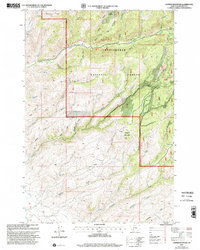
1997 Map of Copper Mountain
USGS Topo · Published 2002About this map
Copper Mountain stands at the center of this mountain landscape in Madison Co., where the high-altitude drainage systems of the Ruby River basin are etched into the terrain. The map records a legacy of hard-rock extraction, with numerous workings such as the Toledo Mine, Smuggler Mine, and Geel Mine concentrated in the northern and eastern gulches. These mineral claims are connected by a network of trails and primitive roads that navigate the complex ridges between Nonpareil Park and the Madison District Beaverhead National Forest.
Find a feature on this map
45 named features on this map. Tap any name to fly to it.
Don’t see what you’re looking for? This feature index may not catch every label — zoom into the map to look around manually.
Map Details
Editions of this 1997 Copper Mountain Map
This is the sole edition of this map. No revisions or reprints were ever made.
Other maps of this area

1888 · Three Forks
USGS Topo · 1:250,000

1893 · Dillon
USGS Topo · 1:250,000

1894 · Three Forks
USGS Topo · 1:250,000

1895 · Three Forks
USGS Topo · 1:250,000

1947 · Bozeman
USGS Topo · 1:250,000

1948 · Bozeman
USGS Topo · 1:250,000

1950 · Harrison
USGS Topo · 1:62,500

1950 · Virginia City
USGS Topo · 1:62,500

1955 · Bozeman
USGS Topo · 1:250,000

1955 · Dillon
USGS Topo · 1:250,000