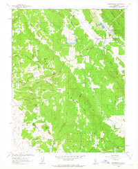
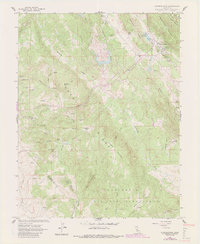
1962 Map of Copperopolis
USGS Topo · Published 1963About this map
The mining landscape of Copperopolis is the central focus of this survey, illustrating a region defined by its mid-century extraction history and rugged topography. Numerous shafts and mining operations are scattered across the terrain, including the Keystone Mine near the Copperopolis Reservoir and the Empire Mine further south. These operations, alongside sites like the Skyrocket Mine and Napoleon Mine, highlight the extensive prospecting that shaped the local economy and settlement patterns within the Copperopolis Ridge.
Find a feature on this map
53 named features on this map. Tap any name to fly to it.
Don’t see what you’re looking for? This feature index may not catch every label — zoom into the map to look around manually.
Map Details
Editions of this 1962 Copperopolis Map
5 editions found
Other maps of this area

1889 · Jackson
USGS Topo · 1:125,000

1892 · Jackson
USGS Topo · 1:125,000

1897 · Jackson
USGS Topo · 1:125,000

1902 · Jackson
USGS Topo · 1:125,000

1915 · Oakdale
USGS Topo · 1:31,680

1916 · Bachelor Valley
USGS Topo · 1:31,680

1916 · Copperopolis
USGS Topo · 1:62,500

1942 · Farmington
USGS Topo · 1:62,500

1942 · Copperopolis
USGS Topo · 1:62,500

1944 · Valley Springs
USGS Topo · 1:62,500
Featured Places
- Telegraph City, CA
- Copper Cove Subdivision, CA
- Copper Cove Village, CA
- Copperopolis, CA
- Stanislaus County, CA