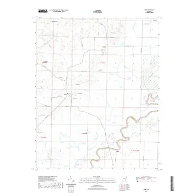
2020 Map of Cord
USGS Topo · Published 2020About this map
Elgin and the meandering Black River anchor this landscape along the Independence and Jackson County line, where the terrain transitions from the elevations of Turkey Hill down to the fertile river bottomlands. The area is characterized by a complex network of waterways and wetlands, including Curia Lake, Swift Slough, and Ray Brake, which suggest a long history of seasonal flooding and changing river courses. Local life is centered around small crossroads communities like Cord and Dowdy, connected by a grid of rural roads such as Lick Creek Rd and Otter Lake Rd. For genealogists and local historians, the presence of Hopewell Cem, Williams Cem, and Happy Cem provides vital reference points for tracing families who settled these wetlands and ridges. The numerous sloughs and lakes, such as Saltwork Slough and Horseshoe Lake, illustrate the intricate hydrology that has defined farming and travel in this corner of Arkansas.
Find a feature on this map
67 named features on this map. Tap any name to fly to it.
Don’t see what you’re looking for? This feature index may not catch every label — zoom into the map to look around manually.
Map Details
Editions of this 2020 Cord Map
This is the sole edition of this map. No revisions or reprints were ever made.
Other maps of this area

1932 · Strawberry
USGS Topo · 1:62,500

1935 · Alicia
USGS Topo · 1:62,500

1935 · Strawberry
USGS Topo · 1:62,500

1935 · Newport
USGS Topo · 1:62,500

1935 · Tuckerman
USGS Topo · 1:62,500

1941 · Strawberry
USGS Topo · 1:62,500

1953 · Memphis
USGS Topo · 1:250,000

1954 · Charlotte
USGS Topo · 1:24,000

1955 · Strawberry
USGS Topo · 1:24,000

1955 · Cord
USGS Topo · 1:24,000