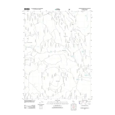
2012 Map of Corders Reservoir
USGS Topo · Published 2012About this map
Blacks Mountain and the high elevations of Blacks Ridge dominate this section of Lassen County, where timber management and seasonal grazing define the land use. The presence of the Eldridge Homestead near the western edge provides a specific point of interest for genealogists tracking local families within the national forest boundaries. A network of Forest Service routes, including Forest Rte 35N10 and Black Gulch Rd, connects various points of interest such as the Blacks Ridge Lookout and the open grazing area of Beaver Creek Pasture. Water resources are central to the landscape, evidenced by numerous named pools and catchments including Corders Reservoir, Busters Reservoir, and Railroad Reservoir, alongside natural features like Blacks Lake and Mud Spring.
Find a feature on this map
26 named features on this map. Tap any name to fly to it.
Don’t see what you’re looking for? This feature index may not catch every label — zoom into the map to look around manually.
Map Details
Editions of this 2012 Corders Reservoir Map
This is the sole edition of this map. No revisions or reprints were ever made.
Other maps of this area

1886 · Lassen Peak
USGS Topo · 1:250,000

1892 · Lassen Peak
USGS Topo · 1:250,000

1894 · Lassen Peak
USGS Topo · 1:250,000

1939 · Halls Flat
USGS Topo · 1:125,000

1955 · Westwood
USGS Topo · 1:250,000

1956 · Harvey Mtn
USGS Topo · 1:62,500

1957 · Prospect Peak
USGS Topo · 1:62,500

1957 · Little Valley
USGS Topo · 1:62,500

1957 · Jellico
USGS Topo · 1:62,500

1958 · Westwood
USGS Topo · 1:250,000