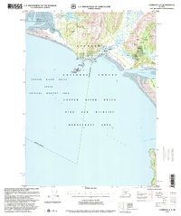
1997 Map of Cordova A-2
USGS Topo · Published 2000About this map
Katalla sits along the shoreline of Katalla Bay, serving as a focal point for early twentieth-century industrial development in this coastal region of the Chugach National Forest. The map documents the infrastructure of the Alaskan oil industry, including a Refinery, Oil seepages, and a Drill Hole located near Katalla Slough. These markings, alongside identified Ruins and a Cem, underscore the transition from an active settlement to a landscape largely reclaimed by nature by the late 1990s.
Find a feature on this map
45 named features on this map. Tap any name to fly to it.
Don’t see what you’re looking for? This feature index may not catch every label — zoom into the map to look around manually.
Map Details
Editions of this 1997 Cordova A-2 Map
This is the sole edition of this map. No revisions or reprints were ever made.
Other maps of this area

1948 · Cordova
USGS Topo · 1:250,000

1948 · Middleton Island
USGS Topo · 1:250,000

1950 · Middleton Island
USGS Topo · 1:250,000

1950 · Cordova B-2
USGS Topo · 1:63,360

1950 · Cordova A-1
USGS Topo · 1:63,360

1950 · Cordova A-2
USGS Topo · 1:63,360

1951 · Cordova
USGS Topo · 1:250,000

1951 · Cordova B-1
USGS Topo · 1:63,360

1952 · Cordova B-3
USGS Topo · 1:63,360

1953 · Cordova A-2
USGS Topo · 1:63,360