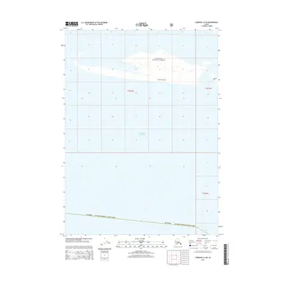
2014 Map of Cordova A-3 NE
USGS Topo · Published 2014About this map
Chugach National Forest encompasses the coastal edge shown in this 2014 survey, where the terrestrial landscape meets the expansive Gulf of Alaska. The map documents a dynamic shoreline characterized by shifting sand and water features, most notably Strawberry Reef and the prominent Softuk Bar at the eastern edge. This area, located within the Valdez-Cordova Census Area, is largely defined by its natural topography rather than permanent settlements, illustrating the wilderness character of the Alaskan coast. The grid lines of T19S R3E and T19S R4E provide a formal structure over a landscape dictated by the tides and the Gulf's maritime influence.
Find a feature on this map
8 named features on this map. Tap any name to fly to it.
Don’t see what you’re looking for? This feature index may not catch every label — zoom into the map to look around manually.
Map Details
Editions of this 2014 Cordova A-3 NE Map
This is the sole edition of this map. No revisions or reprints were ever made.
Other maps of this area

1948 · Cordova
USGS Topo · 1:250,000

1950 · Cordova B-2
USGS Topo · 1:63,360

1950 · Cordova A-2
USGS Topo · 1:63,360

1951 · Cordova
USGS Topo · 1:250,000

1952 · Cordova B-3
USGS Topo · 1:63,360

1953 · Cordova A-2
USGS Topo · 1:63,360

1953 · Cordova B-2
USGS Topo · 1:63,360

1953 · Cordova B-3
USGS Topo · 1:63,360

1959 · Cordova
USGS Topo · 1:250,000
1988 · Cordova A-3
USGS Topo · 1:63,360