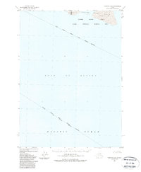
1988 Map of Cordova A-4
USGS Topo · Published 1988About this map
The Copper River delta dominates this coastal environment, where the river's massive sediment load meets the open waters of the Gulf of Alaska. This 1988 map documents a dynamic shoreline defined by shifting tidal flats and sandbars, including Kokinhenik Bar and Grass Island Bar. The transition from riverine outflow to the Pacific Ocean is marked by significant environmental protections, as much of the area falls within the State Critical Habitat Area. These boundaries, along with the Chugach National Forest Boundary, illustrate the intersection of wildlife conservation and federally managed lands in the late twentieth century. With no roads or trails recorded on this portion of the delta, the map preserves a view of a largely untouched coastal wilderness where the river's natural hydrology remains the primary architect of the landscape.
Find a feature on this map
12 named features on this map. Tap any name to fly to it.
Don’t see what you’re looking for? This feature index may not catch every label — zoom into the map to look around manually.
Map Details
Editions of this 1988 Cordova A-4 Map
This is the sole edition of this map. No revisions or reprints were ever made.
Other maps of this area

1948 · Cordova
USGS Topo · 1:250,000

1948 · Middleton Island
USGS Topo · 1:250,000

1950 · Middleton Island
USGS Topo · 1:250,000

1951 · Cordova
USGS Topo · 1:250,000

1951 · Cordova B-4
USGS Topo · 1:63,360

1951 · Cordova B-5
USGS Topo · 1:63,360

1952 · Cordova B-3
USGS Topo · 1:63,360

1953 · Cordova B-5
USGS Topo · 1:63,360

1953 · Cordova B-3
USGS Topo · 1:63,360
1955 · Middleton Island
USGS Topo · 1:250,000