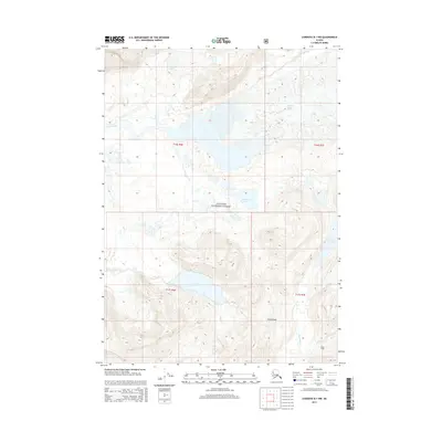
2014 Map of Cordova B-1 NW
USGS Topo · Published 2014About this map
Carbon Camp sits in the southeastern reaches of this glacial landscape within the Chugach National Forest, a rare point of named human activity in a region defined by ice and water. The map traces the massive Martin River Glacier and Slide Glacier, which feed a complex network of glacial meltwater including the Martin River and multiple smaller tributaries. Prominent water bodies like Lake Tokun and the isolated Deadwood Lake are framed by the elevations of Tokun Ridge. The drainage patterns are clearly defined by the paths of Shepherd Cr, Tokun Cr, and Carbon Cr, illustrating how the shifting ice of the Copper River delta region shapes the local topography and accessible land routes for modern explorers and researchers.
Find a feature on this map
18 named features on this map. Tap any name to fly to it.
Don’t see what you’re looking for? This feature index may not catch every label — zoom into the map to look around manually.
Map Details
Editions of this 2014 Cordova B-1 NW Map
This is the sole edition of this map. No revisions or reprints were ever made.
Other maps of this area

1948 · Cordova
USGS Topo · 1:250,000

1950 · Cordova B-2
USGS Topo · 1:63,360

1951 · Cordova
USGS Topo · 1:250,000

1951 · Cordova B-1
USGS Topo · 1:63,360

1953 · Cordova B-1
USGS Topo · 1:63,360

1953 · Cordova B-2
USGS Topo · 1:63,360

1959 · Cordova C-2
USGS Topo · 1:63,360

1959 · Cordova C-1
USGS Topo · 1:63,360

1959 · Cordova
USGS Topo · 1:250,000
1997 · Cordova B-2
USGS Topo · 1:63,360