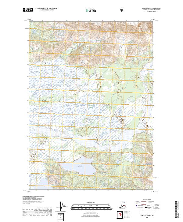
2024 Map of Cordova B-2 NE
USGS Topo · Published 2024About this map
Chugach National Forest encompasses this coastal Alaskan landscape, where the topography transitions from steep, glaciated mountain ridges in the north to a complex network of wetlands and water bodies in the south. The southern half of the map is defined by the significant basins of Martin Lake and Little Martin Lake, which are linked by intricate drainage systems that underscore the region's high hydrologic activity. Along the eastern edge, Tokun Creek flows through a narrow corridor between the rising slopes and the low-lying marshlands. This survey illustrates a wilderness nearly devoid of human infrastructure, focusing instead on the natural boundaries and water systems that dictate movement and land use within the national forest. The sharp contrast between the 3,000-foot peaks and the sea-level wetlands illustrates the dynamic geological forces at work near the Gulf of Alaska.
Find a feature on this map
8 named features on this map. Tap any name to fly to it.
Don’t see what you’re looking for? This feature index may not catch every label — zoom into the map to look around manually.
Map Details
Editions of this 2024 Cordova B-2 NE Map
This is the sole edition of this map. No revisions or reprints were ever made.
Other maps of this area

1948 · Cordova
USGS Topo · 1:250,000

1950 · Cordova B-2
USGS Topo · 1:63,360

1951 · Cordova
USGS Topo · 1:250,000

1951 · Cordova B-1
USGS Topo · 1:63,360

1953 · Cordova B-1
USGS Topo · 1:63,360

1953 · Cordova B-2
USGS Topo · 1:63,360

1959 · Cordova C-2
USGS Topo · 1:63,360

1959 · Cordova C-1
USGS Topo · 1:63,360

1959 · Cordova
USGS Topo · 1:250,000
1997 · Cordova B-2
USGS Topo · 1:63,360