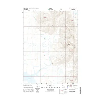
2014 Map of Cordova B-2 SW
USGS Topo · Published 2014About this map
Martin River Slough and Mirror Slough meander through a labyrinthine delta landscape, illustrating the complex hydrography of this coastal region within the Chugach National Forest. The presence of the Bennett Rock Cabin offers a rare point of human interest in an area dominated by the towering Chugach Mountains and Ragged Mountain. To the south, the terrain meets the open waters of the Gulf of Alaska, while Martin Lake sits tucked into the northeastern corner of the quadrangle. The map captures the specialized geography of the Alaska coast, where glacial runoff and tidal influences shape a network of shifting waterways and remote wilderness reaches.
Find a feature on this map
14 named features on this map. Tap any name to fly to it.
Don’t see what you’re looking for? This feature index may not catch every label — zoom into the map to look around manually.
Map Details
Editions of this 2014 Cordova B-2 SW Map
This is the sole edition of this map. No revisions or reprints were ever made.
Other maps of this area

1948 · Cordova
USGS Topo · 1:250,000

1950 · Cordova B-2
USGS Topo · 1:63,360

1950 · Cordova A-2
USGS Topo · 1:63,360

1951 · Cordova
USGS Topo · 1:250,000

1952 · Cordova B-3
USGS Topo · 1:63,360

1953 · Cordova A-2
USGS Topo · 1:63,360

1953 · Cordova B-2
USGS Topo · 1:63,360

1953 · Cordova B-3
USGS Topo · 1:63,360

1959 · Cordova
USGS Topo · 1:250,000
1988 · Cordova A-3
USGS Topo · 1:63,360