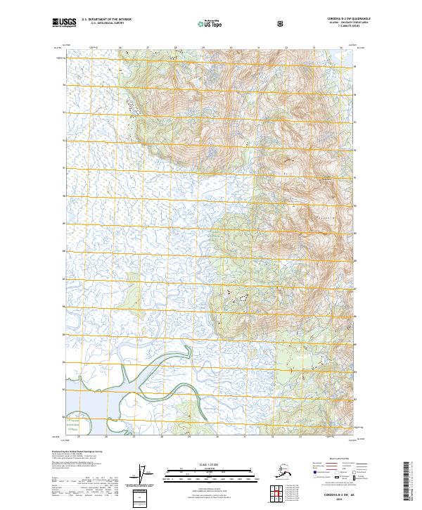
2024 Map of Cordova B-2 SW
USGS Topo · Published 2024About this map
The Chugach Mountains dominate the eastern landscape of this coastal Alaskan region, where the steep slopes of Ragged Mtn transition into a complex drainage system. This topography is defined by the shifting waters of the Martin River Slough and Mirror Slough, which weave through the lowlands of the Chugach National Forest. The map illustrates a wilderness largely defined by its hydrological patterns, showing how glacial runoff and coastal tides shape the braided channels and wetlands. There are no marked roads or settlements on this survey, highlighting the remote character of the Copper River Delta vicinity where the mountains meet the sprawling river flats.
Find a feature on this map
11 named features on this map. Tap any name to fly to it.
Don’t see what you’re looking for? This feature index may not catch every label — zoom into the map to look around manually.
Map Details
Editions of this 2024 Cordova B-2 SW Map
This is the sole edition of this map. No revisions or reprints were ever made.
Other maps of this area

1948 · Cordova
USGS Topo · 1:250,000

1950 · Cordova B-2
USGS Topo · 1:63,360

1950 · Cordova A-2
USGS Topo · 1:63,360

1951 · Cordova
USGS Topo · 1:250,000

1952 · Cordova B-3
USGS Topo · 1:63,360

1953 · Cordova A-2
USGS Topo · 1:63,360

1953 · Cordova B-2
USGS Topo · 1:63,360

1953 · Cordova B-3
USGS Topo · 1:63,360

1959 · Cordova
USGS Topo · 1:250,000
1988 · Cordova A-3
USGS Topo · 1:63,360