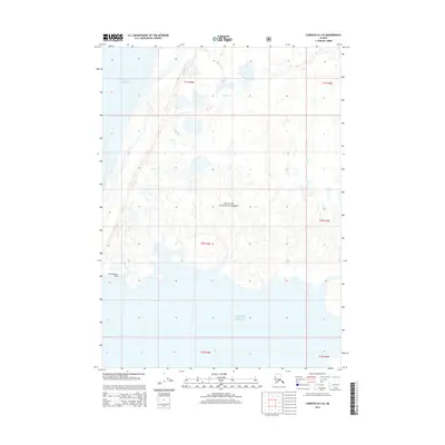
2014 Map of Cordova B-3 SE
USGS Topo · Published 2014About this map
Chugach National Forest land dominates this coastal Alaskan landscape, where the glacial influence and marine environment meet. The southern portion of the sheet is defined by the Gulf of Alaska, featuring the prominent coastal landmark at Cottonwood Point. The topography here is characterized by a complex network of wetlands and small water bodies that signify the dynamic shoreline of the Unorganized Borough. This 2014 survey reflects the modern configuration of the coastline, managed by agencies like the U.S. Forest Service, and provides a detailed view of the terrain before further natural coastal shifts occur.
Find a feature on this map
9 named features on this map. Tap any name to fly to it.
Don’t see what you’re looking for? This feature index may not catch every label — zoom into the map to look around manually.
Map Details
Editions of this 2014 Cordova B-3 SE Map
This is the sole edition of this map. No revisions or reprints were ever made.
Other maps of this area

1948 · Cordova
USGS Topo · 1:250,000

1950 · Cordova B-2
USGS Topo · 1:63,360

1950 · Cordova A-2
USGS Topo · 1:63,360

1951 · Cordova
USGS Topo · 1:250,000

1952 · Cordova B-3
USGS Topo · 1:63,360

1953 · Cordova A-2
USGS Topo · 1:63,360

1953 · Cordova B-2
USGS Topo · 1:63,360

1953 · Cordova B-3
USGS Topo · 1:63,360

1959 · Cordova
USGS Topo · 1:250,000
1988 · Cordova A-3
USGS Topo · 1:63,360