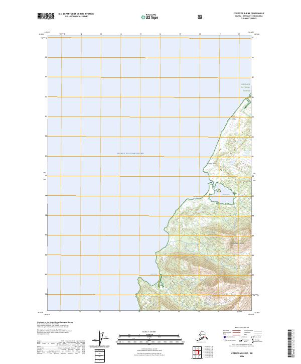
2024 Map of Cordova B-8 NE
USGS Topo · Published 2024About this map
Chugach National Forest encompasses the coastal wilderness of Hinchinbrook Island along the eastern reaches of Prince William Sound. The terrain is defined by steep maritime elevations and a complex shoreline where protected inlets like Shelter Bay and Deer Cove meet the open water. A series of prominent peaks known as The Seven Sisters stands watch over the sound's northern approaches near Shelter Point. This survey captures a landscape primarily untouched by modern infrastructure, emphasizing the natural hydrography and topographical boundaries of this remote island environment. The absence of roads or permanent settlements highlights the protected status of the national forest and the nautical character of the region, where access remains dependent on the tides and the sea.
Find a feature on this map
11 named features on this map. Tap any name to fly to it.
Don’t see what you’re looking for? This feature index may not catch every label — zoom into the map to look around manually.
Map Details
Editions of this 2024 Cordova B-8 NE Map
This is the sole edition of this map. No revisions or reprints were ever made.
Other maps of this area

1948 · Cordova
USGS Topo · 1:250,000

1950 · Cordova C-7
USGS Topo · 1:63,360

1950 · Cordova B-7
USGS Topo · 1:63,360

1950 · Cordova C-8
USGS Topo · 1:63,360

1951 · Cordova
USGS Topo · 1:250,000

1951 · Cordova B-8
USGS Topo · 1:63,360

1952 · Cordova C-8
USGS Topo · 1:63,360

1953 · Cordova B-7
USGS Topo · 1:63,360
1953 · Cordova C-7
USGS Topo · 1:63,360
1953 · Cordova B-8
USGS Topo · 1:63,360