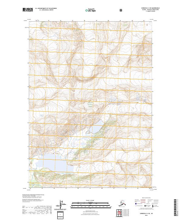
2024 Map of Cordova C-2 SE
USGS Topo · Published 2024About this map
Chugach National Forest encompasses the high-altitude landscape of this Alaskan interior, dominated by massive ice fields and active glacial movement. The sheet provides a detailed record of the glacial extent and drainage patterns within the t14s r5e and t15s r6e survey blocks, where the topographical data reveals the sheer scale of the frozen terrain. Huge ice masses, specifically McPherson Glacier, Miles Glacier, and Johnson Glacier, are the defining geographic elements of the region. These glaciers carve through the mountain ranges, feeding into unnamed alpine lakes and high-elevation basins. The map illustrates a wilderness largely untouched by permanent settlement or infrastructure, focusing instead on the natural borders and the complex contours of the Chugach Range.
Find a feature on this map
10 named features on this map. Tap any name to fly to it.
Don’t see what you’re looking for? This feature index may not catch every label — zoom into the map to look around manually.
Map Details
Editions of this 2024 Cordova C-2 SE Map
This is the sole edition of this map. No revisions or reprints were ever made.
Other maps of this area

1948 · Cordova
USGS Topo · 1:250,000

1950 · Cordova B-2
USGS Topo · 1:63,360

1951 · Cordova
USGS Topo · 1:250,000

1951 · Cordova B-1
USGS Topo · 1:63,360

1953 · Cordova B-1
USGS Topo · 1:63,360

1953 · Cordova B-2
USGS Topo · 1:63,360

1959 · Cordova C-2
USGS Topo · 1:63,360

1959 · Cordova C-1
USGS Topo · 1:63,360

1959 · Cordova
USGS Topo · 1:250,000
1997 · Cordova B-2
USGS Topo · 1:63,360