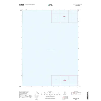
2018 Map of Cordova C-8 SE
USGS Topo · Published 2018About this map
Prince William Sound occupies the vast majority of this maritime survey in the Valdez-Cordova Census Area. The map depicts a nearly entirely aquatic landscape, focusing on the open waters of the sound as they appeared in the late 2010s. Terrestrial data is limited to the northern and southern margins, where legal land descriptions for T14s R8w and T16s R8w delineate the cadastral grid over what would be the adjacent landmasses. This specific sheet is notable for its minimalist composition, serving primarily to document the hydrographic expanse and the projected Public Land Survey System boundaries over the Alaskan coastal waters. It provides a specialized perspective for those studying the administrative maritime divisions and the geographical extent of the sound relative to the regional township and range system.
Find a feature on this map
3 named features on this map. Tap any name to fly to it.
Don’t see what you’re looking for? This feature index may not catch every label — zoom into the map to look around manually.
Map Details
Editions of this 2018 Cordova C-8 SE Map
This is the sole edition of this map. No revisions or reprints were ever made.
Other maps of this area

1948 · Cordova
USGS Topo · 1:250,000

1950 · Cordova C-7
USGS Topo · 1:63,360

1950 · Cordova B-7
USGS Topo · 1:63,360

1950 · Cordova C-8
USGS Topo · 1:63,360

1951 · Cordova
USGS Topo · 1:250,000

1951 · Cordova B-8
USGS Topo · 1:63,360

1952 · Cordova C-8
USGS Topo · 1:63,360

1953 · Cordova B-7
USGS Topo · 1:63,360
1953 · Cordova C-7
USGS Topo · 1:63,360
1953 · Cordova B-8
USGS Topo · 1:63,360