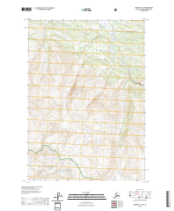
2024 Map of Cordova D-1 NW
USGS Topo · Published 2024About this map
Wrangell-St. Elias Wilderness dominates this high-altitude landscape where the complex drainage of the Bremner River basin has carved deep into the terrain. The map captures the meeting point between the wilderness area and the Chugach National Forest to the southwest, a region defined by its lack of human infrastructure and focus on natural preservation. Waterways like the South Fork Bremner River and Eagle Creek serve as the primary landmarks in a geography that transitions through Threemile Canyon. This survey illustrates the extreme isolation of this portion of Alaska, where the landscape is organized by township and range lines rather than roads or settlements. The topographic data reveals a primitive environment where steep elevation changes and glacial river forks dictate the flow of the land.
Find a feature on this map
11 named features on this map. Tap any name to fly to it.
Don’t see what you’re looking for? This feature index may not catch every label — zoom into the map to look around manually.
Map Details
Editions of this 2024 Cordova D-1 NW Map
This is the sole edition of this map. No revisions or reprints were ever made.
Other maps of this area

1948 · Cordova
USGS Topo · 1:250,000

1951 · Cordova
USGS Topo · 1:250,000

1951 · Valdez A-1
USGS Topo · 1:63,360

1951 · Valdez A-2
USGS Topo · 1:63,360

1952 · Valdez
USGS Topo · 1:250,000
1957 · Valdez A-2
USGS Topo · 1:63,360

1959 · Cordova D-1
USGS Topo · 1:63,360

1959 · Cordova D-2
USGS Topo · 1:63,360

1959 · Cordova
USGS Topo · 1:250,000

1960 · Valdez
USGS Topo · 1:250,000